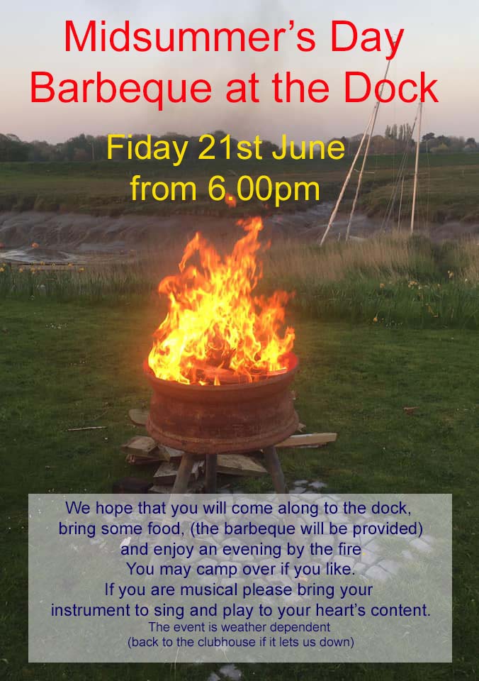
On Friday 21st June, the longest day, the club will be closed as we will be lighting the BBQ at the dock from 6pm. We hope you will come along, bring some food & enjoy a get together around the fire. You can also camp over if you like – remember it’s Lytham Club Day on Saturday! If there are any musicians amongst you, please feel free to bring your instruments and sing & play to your heart’s content – I can’t guarantee we won’t join in though! Of course this event is weather dependent so if it lets us down, we will confirm postponement & the club will be open as usual. Fingers crossed for some summer warmth & sunshine!!
Captain Barnacle
Feb092019
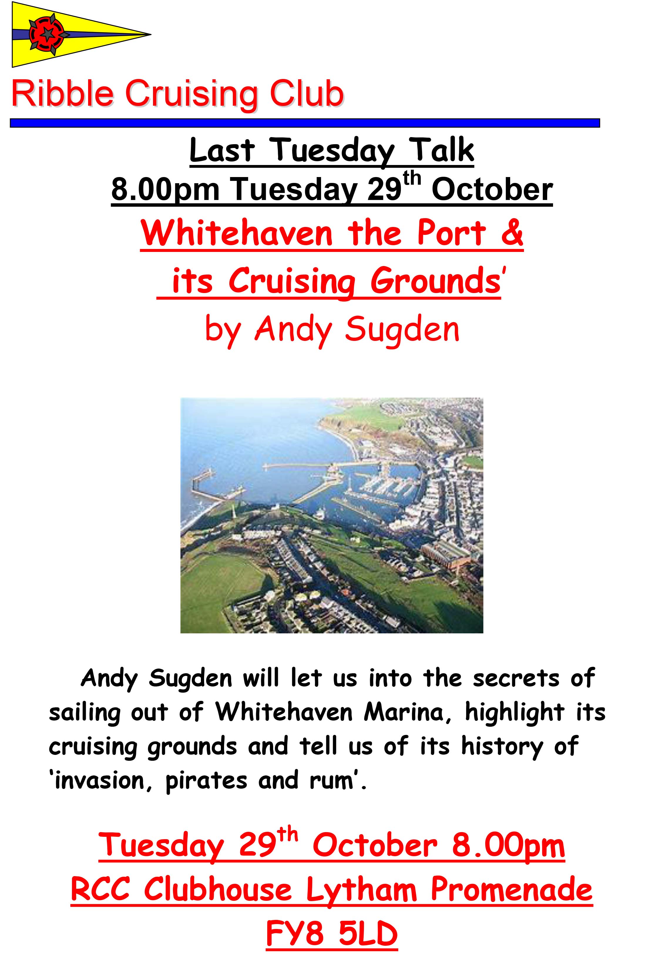
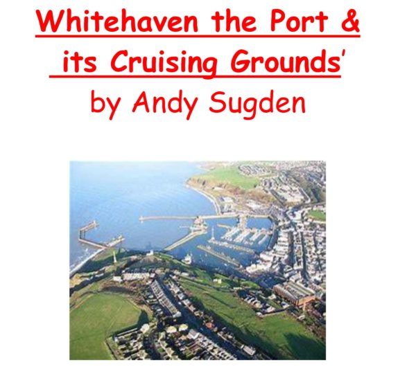
Last Tuesday Talk -February 26th -St Kilda and its history by Steve Halliwell
On Saturday 17th March 2018 the Worshipful the Mayor of Fylde, Councilor John Singleton J.P, and the Mayoress of Fylde, Mrs Geraldine Singleton M.B.E, attended the Commodore’s Sherry Evening at Ribble Cruising Club.
Hosted by the current Commodore, Peter Benett, the Mayor and Mayoress commented “the company was delightful and the atmosphere in the club house was vibrant, buzzing almost. Thank you everyone for your kind and generous hospitality”.
Captain Barnacle
Feb202018
Notice to Mariners -SHELL FLATS MET MAST -update 12.03.2018
Attached is the NtM first issued on Monday 5th February byORSTED (formerly DONG ENERGY) concerning the removal of the two Met Masts which are situated on the SHELL FLATS BANK.
The trellis, or upper works, on both masts have now been removed but the pile foundations are still in place, temporary navigation lights have been installed and are working on both structures.
The self-propelled offshore construction jack up vessel ‘WIND’ is on site and will transit between both Met Mast positions as required and as already advertised this work is expected to last for approx. 28days, depending on weather and conditions.
Picture and details of ‘WIND’ are on the attached NtM.
The two METEROLOGICAL MASTS are situated at the following positions:
No. 1, 80m mast Lat 53° 52’ 423 Long 003° 12’ 133
No. 2, 50m mast Lat 53° 51’ 600 Long 003° 17’ 663
Also attached with this notice is a picture of both masts as well as a small chartlet showing their location on the Shell Flats Bank.
Please note that the chartlet is provided for information purposes only and should not be used for navigation.
Please do not hesitate to contact me if you are unsure about any of the above, or the attached, or if you require any further information, also please pass this information to any of your colleagues who you think might be interested.
If you know of any fisherman who works the area and does not receive this information or anybody else who would benefit from this information please let me know.
Regards : Tom Watson
Tel………. Mobile 07903 173 624
Home 01253 875565
SHELL FLATS METEROLOGICAL MASTS – REMOVAL – FURTHER UPDATE ARRIVAL OF JACK-UP VESSEL ‘WIND
Dear All,
UP-DATE TO REMOVAL OF MET MASTS
SHELL FLATS
Attached is the up-date to the NtM first issued on Monday 5th February byORSTED (formerly DONG ENERGY) concerning the removal of the two Met Masts which are situated on the SHELL FLATS BANK.
This work will be undertaken by the self-propelled offshore construction jack up vessel ‘WIND’ and is now scheduled to start on or around Thursday 8th Marchand as already advertised is expected to last for approx. 28days, depending on weather and conditions.
‘WIND’ is currently on passage, off Padstow, and can be expected to arrive on site late tomorrow/early Thursday, picture and details of ‘WIND’ are on the attached NtM.
The two METEROLOGICAL MASTS are situated at the following positions:
No. 1, 80m mast Lat 53° 52’ 423 Long 003° 12’ 133
No. 2, 50m mast Lat 53° 51’ 600 Long 003° 17’ 663
Also attached with this notice is a picture of both masts as well as a small chartlet showing their location on the Shell Flats Bank.
Please note that the chartlet is provided for information purposes only and should not be used for navigation.
Please do not hesitate to contact me if you are unsure about any of the above, or the attached, or if you require any further information, also please pass this information to any of your colleagues who you think might be interested.
If you know of any fisherman who works the area and does not receive this information or anybody else who would benefit from this information please let me know.
Regards : Tom Watson
Tel………. Mobile 07903 173 624
Home 01253 875565
Dear All,
UP-DATE TO REMOVAL OF MET MASTS
Attached is an up-date to the NtM first issued on Monday 5th February byORSTED (formerly DONG ENERGY) concerning the removal of the two Met Masts which are situated on the SHELL FLATS BANK.
This Ntm has been further up-dated and work is now scheduled to start on or around Monday 26th February and as already advertised is expected to last for approx. 28days, depending on weather and conditions.
It will be undertaken by the self-propelled offshore construction jack up vessel ‘WIND’, currently in the English Channel on passage to site. Picture and details of ‘WIND’ are on the attached NtM.
The two METEROLOGICAL MASTS are situated at the following positions:
No. 1, 80m mast Lat 53° 52’ 423 Long 003° 12’ 133
No. 2, 50m mast Lat 53° 51’ 600 Long 003° 17’ 663
Also attached with this notice is a picture of both masts as well as a small chartlet showing their location on the Shell Flats Bank.
Please note that the chartlet is provided for information purposes only and should not be used for navigation.
Please do not hesitate to contact me if you are unsure about any of the above, or the attached, or if you require any further information, also please pass this information to any of your colleagues who you think might be interested.
If you know of any fisherman who works the area and does not receive this information or anybody else who would benefit from this information please let me know.

 Captain Barnacle

 Captain Barnacle

 Captain Barnacle
 Captain Barnacle
 Captain Barnacle