A weekend specialist course for more advanced dinghy sailors, to improve their skills ahead of the new season. We will be using ‘2000 performance’ dinghies. Amongst other exercises you will be undertaking; sailing without a rudder, man over board, anchoring, sailing backwards, capsize drills. You will need reasonable previous dinghy experience and it will be physically demanding.
Captain Barnacle
Jan092019
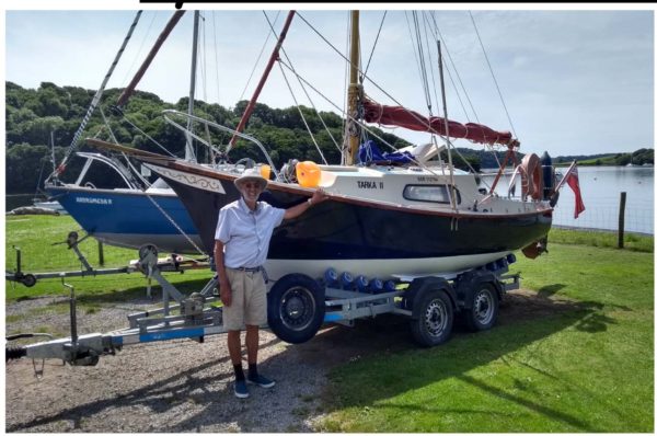
January 29th -Last Tuesday Talk -Trailer Sailing in Devon with Oliver Shaw
WEST of DUDDON SANDS – WOWO3+4 EXPORT CABLES NEARSHORE SURVEY – POST CONSTRUCTION BATHYMETRIC SURVEY – POSITIONS OF REMOVED SHELL FLATS MET MASTS
CHANGE OF SCHEDULE
The previously advertised Bathymetric survey, expected to start on or around Monday 10th September at the WEST of DUDDON SANDS WIND FARM, will now start with the survey of the near shore Export Cables of the WALNEY (EXT) WOWO3+4 WIND FARM.
The third attachment is a small chartlet which shows the area of survey operations, between KP 4.6 and KP 5.8. The area ismarked in WGS84 Format Degrees, Minutes, Decimal and the main focus areas are marked as a red spots.
All surveys will be carried out by the 10 meter inshore survey vessel ‘EGS WATCHFUL’ (picture attached) working on a 12hr day basis (daylight hours only)
………………………………………………………………..
The Bathymetric Survey at the WEST of DUDDON SANDS WIND FARM will start as soon as the Export Cable survey has completedand this survey will cover all of the Turbine positions, all of the Inter-Array or Infield Cables, the Offshore Sub-Station, the Met Mast and the Export Cable.
Once completed this survey will be immediately followed by a survey of the two, now removed, Met Masts positions on the Shell Flats
As ‘EGS WATCHFUL’ will be using highly sensitive Multi-Beam Echo Sounders as well as highly sensitive motion sensors a wide berth, 500 meters, is requested around ‘EGS WATCHFUL’ at all times while on site and passing vessels are requested to reduce speed if possible, these surveys are not expected to interfere with any other vessel.
Dependant on weather and conditions survey operations are expected to last for approx. 3 to 4 weeks,
A listening watch will be kept on VHF Channels 16 & 12 and ‘EGS WATCHFUL’ can be contacted for information relating to vessel movement only.
Attached for information is the ‘Kingfisher Flyer’ which gives all of the relevant information concerning the WEST of DUDDON SANDS WIND FARM including the Export Cable routes, there is also a picture of ‘EGS WATCHFUL’ also attached is the small chartlet showing the now removed Met Mast positions on the Shell Flats.
Please note that the ‘Flyers’ and chartlets are for provided for information purposes relating to the Wind Farm and surveys only and should not be used for navigation.
Please do not hesitate to contact me if you are unsure about any of the above or require any further information, also please pass this information to any of your colleagues who you think might be interested.
If you know of any fisherman who works the area and does not receive this information or anybody else who would benefit from this information please let me know.

 Captain Barnacle
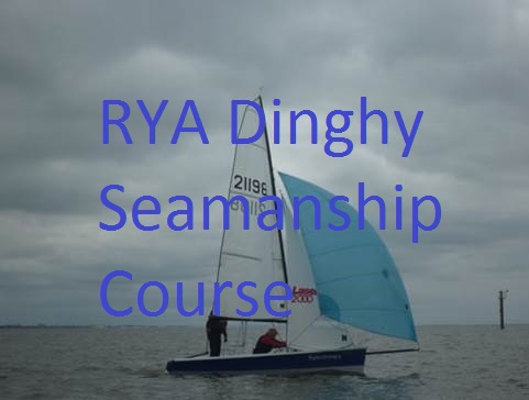 Captain Barnacle

 Captain Barnacle
 Captain Barnacle